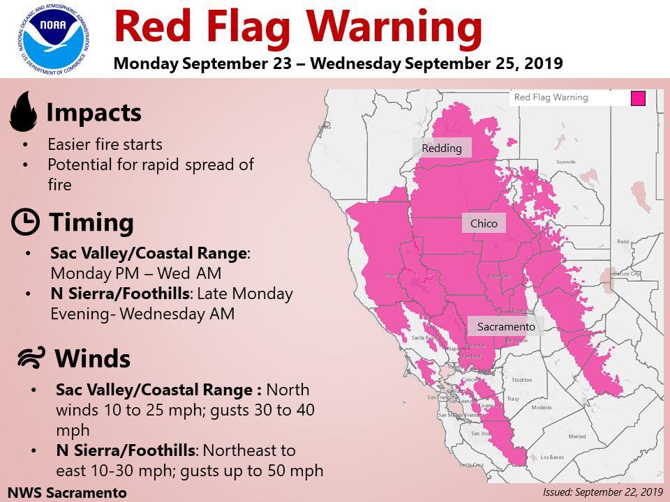
Red Flag Warning in effect from 11 PM Monday to 11 AM PDT Wednesday parts of the Central Valley, the Coastal Range and the Sierra below 5000 feet. The Fire Weather Watch is no longer in effect.
Building high pressure will result in gusty north to east wind developing Monday and persisting into early Wednesday. Combined with warming temperatures and lowering humidity, this will result in critical fire weather conditions across portions of Interior Northern California.
* Wind...North wind 10 to 25 mph with local gusts 30 to 40 mph.
* Humidity...Daytime humidity in the 10 to 20 percent range with poor overnight recoveries of 30 to 40 percent, locally lower.
* Highest Threat...Western portions of the Sacramento Valley, and adjacent foothills, where highest wind gusts and lowest humidity are expected.
* Impacts...any fires that develop will likely spread rapidly. Outdoor burning is not recommended.
Precautionary/Preparedness Actions
A Red Flag Warning means that critical fire weather conditions are either occurring now, or will shortly. A combination of strong winds, low relative humidity, and warm temperatures can contribute to extreme fire behavior.